The CRTR Program has a range of remote sensing-related publications as well as Peer Reviewed Publications.
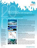 |
Research Update May 2009
New frontiers of remote sensing for reef managementRemote sensing provides valuable tools that resource managers can use at all stages of coral reef conservation. The Remote Sensing Working Group of the Coral Reef Targeted Research & Capacity Building for Management (CRTR) Program, has been working to enhance remote sensing tools to better enable coral reef management, and as part of their work, have recently released a Research Update on how to measure stress on coral reefs and mapping reefs and spatial-decision making, along with the available tools to assist managers.
>> Download [PDF, 330KB]
|
|
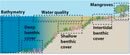 |
Coastal Remote Sensing Toolkit
This toolkit shows managers, scientists and technicians working in coastal marine environments how images, collected from satellites and aircraft, can be used to map and monitor changes to indicators of coastal ecosystem health. This toolkit focuses on coastal water bodies, seagrass, coral reefs, and mangroves.
>> View
|
|
 |
NOAA's Coral Reef Watch
Free online data resources for reef managers.
>> Enter site
|
|
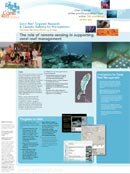 |
Poster: CRTR Program Remote Sensing Working Group
A look at the role of remote sensing in supporting coral reef management.
>> Download
|
|
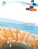 |
Brochure: CRTR Program Summary
A comprehensive introduction to the CRTR Program’s objectives and goals against its research and capacity building agenda.
>> Download
|
|
 |
Research Update, July 2008
Read about the progress of the Remote Sensing Working Group.
>> Download
|